The Allegheny Front Trail is a 42-mile loop through Moshannon State Forest that roughly encircles Black Moshannon State Park It is the longest hiking trail entirely within Centre County.
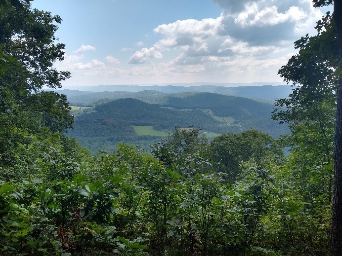
Central Pennsylvania features a geologic structure called the Allegheny Front — an abrupt uprising in the landscape that marks the boundary between the parallel valleys and sharp ridges of the aptly-named Ridge and Valley Province to the south and east, and the high jumbled hills of the Allegheny Plateau to the north and west. This dramatic change in the landscape can be clearly seen on a drive from State College to Philipsburg. It provides many stunning vistas as well.
For about three miles, the Allegheny Front Trail visits several vistas off the edge of the front and toward the State College area. Over the rest of its course the trail visits a wide variety of forest ecosystems, including wetlands and high meadows, and it also follows the scenic but polluted Moshannon Creek for a significant distance. That creek, known colloquially as the “Red Moshannon,” is visibly orange in color due to centuries of acid leakage from defunct coalmines.
The origins of the Allegheny Front Trail date to the early 1980s, when cross-country skiers developed their own trails on the plateau above the edge of the Allegheny Front. The area was high enough to accumulate a lot of snow, while avoiding the jagged rocks that are prevalent in much of Central Pennsylvania. To the east of Black Moshannon State Park, the 12-mile Rock Run Trail System allowed skiers to follow a series of old logging railroad beds, some of which are of significant historical interest.
That trail became popular with hikers, who were welcomed to use skiing trails during the non-winter months. This inspired calls for a more significant backpacking loop, leading to the completion of the Allegheny Front Trail in the late 1990s.
The trail made use of some of the skiing trails and continued onto a newly constructed route of its own. The trail also makes use of segments of the Great Shamokin Path and Bald Eagle’s Path, both of which had been used by Native Americans for centuries.
Scouting and construction were supervised by veteran trail builder and local historian Ralph Seeley, a longtime resident of Bellefonte. Seeley was assisted by his hiking colleague Tom Thwaites, who for almost thirty years led the Penn State Outing Club and who also founded the Mid State Trail.
The Allegheny Front Trail features two expansive vistas named in honor of Seeley — Ralph’s Pretty Good View and Ralph’s Majestic Vista. The Allegheny Front Trail is marked with orange blazes and can be reached from two different trailheads on State Route 504, and from two different side trails that originate in the state park.
Ben Cramer
Sources:
Cramer, Ben. Guide to the Allegheny Front Trail, second edition. Spring Mills, PA: Scott Adams Enterprises, 2014.
Seeley, Ralph. Foot Trails of the Moshannon and Southern Elk State Forests, fourth edition. Spring Mills, PA: Scott Adams Enterprises, 2014.
Seeley, Ralph. Greate Buffaloe Swamp: A Trail Guide and Historical Record for the Quehanna Plateau and the Moshannon State Forest, second edition, self-published, 1997.
First Published: November 2, 2021
Last Modified: April 17, 2025