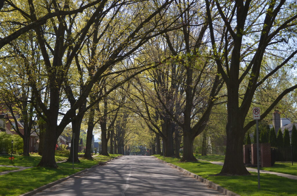
College Heights is a residential neighborhood in State College that was originally developed to provide housing for Penn State faculty, staff, and students. Much of the neighborhood is included in a National Register Historic District that recognizes the diversity of architectural styles, the cohesive scale, and the well-designed landscape of the district.
The neighborhood, which has more than 500 residential properties, was established on a relatively level strip of farm land stretching from the highest area on the campus and gradually sloping downwards as one advances northwards to the limits of the neighborhood and today’s boundary with Ferguson Township.
The bulk of what became College Heights came from the farms of John and Frederick Krumrine to the west of Burrowes Street, and the farm of Henry Hartwick to the east. These farms, then in the northeastern corner of Ferguson Township, were originally owned by Centre Furnace ironmasters James Irvin and Moses Thompson. John Krumrine’s 1852 farmhouse, at the corner of Ridge Avenue and Burrowes Street, is the oldest house in the district.
The first homes in College Heights were built starting around 1905 along Park Avenue and extending north on the intersecting Allen and Burrowes streets. North Allen Street was the primary thoroughfare at that time through the campus, going north to Krumrine Station, a stop on the Bellefonte Central Railroad, about where it today crosses Atherton Street.
Through the 1910s and 1920s, homes were mainly developed along the streets branching off from Allen and Atherton streets. With a final 1931 land addition, the borough’s northern boundary of College Heights was complete, and development continued to spread into these areas through the 1960s and 1970s.
As a residential development, College Heights grew relatively quickly, responding to the constant demand for additional housing from Penn State’s growth. While there were only fifteen houses in place by 1920, another sixty-nine were added by the end of the decade More than 200 additional homes were built in the 1930s .
Home styles varied in these early periods, ranging from small bungalows and Prairie style Four Squares to larger Dutch Colonials. Penn State administrators such education dean W.G. Chambers built more imposing Colonial Revival styles on West Park Avenue overlooking the college’s golf course. However, mail-order houses, pattern book designs, and architect-designed houses, some done by Penn State faculty members themselves, were built in a wide variety of Tudor, Cape Cod, Dutch Colonial, and other styles.
Arthur Cowell, the first head of Penn State’s Landscape Architecture Department in the 1920s, and a College Heights resident, is given much of the credit for the park-like appearance of the neighborhood. He also customized his own Dutch Colonial Sears catalog house.
In the late 1940s, 1950s, and 1960s, even more modern houses in the international style began to appear in west College Heights, many designed by local and faculty architects. While the emphasis in the neighborhood was always on family residences, student housing in the form of rooming houses, and even two fraternities, were operated. Student rentals today have become increasingly common, especially along East Park Avenue and the streets closest to campus.
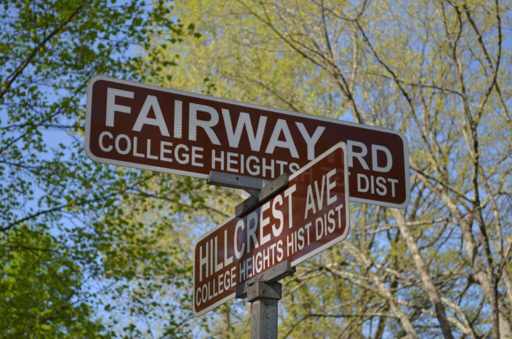
There are no commercial structures in the neighborhood except for the College Heights Service Station, built in the cottage style in 1935 by the Krumrine family at the corner of Hillcrest Avenue and North Atherton Street. The Krumrine family also donated the property across Hillcrest for the site of the College Heights Elementary School, built in 1930 and expanded in 1938. Today, the school building is owned by the university and used for administrative offices.
Another notable feature of College Heights is Sunset Park at the north end of McKee Street. The original portion of land was donated to the borough by the Hartswick family around 1931. Sunset Park expanded in 1982 after additional land became available. The College Heights residents launched a door-to-door fundraiser to purchase the property. Today, Sunset Park is part of the Centre Region’s park system.

College Heights created its own neighborhood association in 1924, perhaps the first in the borough, which actively campaigned for improvements and amenities such as sidewalks and street lighting as well as street trees and neighborhood beautification.
Over time, drivers northbound on Atherton Street began using North Allen Street to avoid the traffic intersection at Park Avenue and Atherton. By 1996, this became such an issue that three traffic diverters were installed in East College Heights to prevent drivers from using the neighborhood as a shortcut. While controversial, these diverters solved the traffic problem in College Heights, although the installation increased traffic on Park Avenue.
In recent decades, the neighborhood association confronted other issues, particularly related to noise and parking problems. Some property owners sought to turn their homes into student rentals while others wanted to create temporary house rentals for football weekends and other special events.
The College Heights National Register Historic District was created in 1995, along with the Highlands and Holmes-Foster Historic districts on the south side of College Avenue, through the work of the Centre County Historical Society. Subsequently, the borough established a Historic Resources Commission, which developed educational programs, including a walking tour brochure, and created a historical review process to advise the Planning Commission in addressing requests to make changes to structures in the three historic districts.
Juliana Hart
Sources:
Melander, Jacqueline. The College Heights Historic Neighborhood brochure. State College: Historic Resources Commission.
State College Borough. Historical Architecture Review Board (HARB). https://statecollegepa.us/563/Historical-Architectural-Review-Board-HARB
Turchick, James. “The History and Future of the College Heights School.” Onward State, September 22, 2016.
United States Department of the Interior National Park Service. National Register of Historic Places Registration Form. College Heights Historic District 1995.
First Published: April 28, 2024
Last Modified: April 29, 2024